If you’ve ever taken a ride up Brushy Ridge Road, you might have noticed an ancient stone arch on the side of the street framing a rusted wrought-iron gate. It is seemingly a gateway to nowhere, as looking beyond it one can’t see a house, cemetery, steps or anything of apparent significance. Adding to the mystery is another arch at the top of Brushy Ridge that looks like something out of Stonehenge.
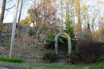
The stone arch on Brushy Ridge Road.” Credit: Terry Dinan / NewCanaanite.com
Rewind about 140 years.
Local history says that William H. Thomson was a doctor in New York City in the mid-late 19th century. Like many of his colleagues, he purchased a large amount of land in New Canaan eventually building a home on his 52-acre estate on Brushy Ridge called “The Rockery.”
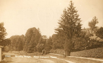
An old postcard view of the stone arch when the property was open to the public.”
Religion was a very big part of Thomson’s life, as his father had been a missionary in the Near East and highly regarded spiritual author and lecturer. According to the New Canaan Historical Society publication Portrait of New Canaan by Mary Louise King, Thomson himself was born in Beirut and spent a significant part of his young adult life there before moving to the United States. It was here that he began studying medicine and serving in the Civil War as a quarantine officer, ultimately spending the majority of his career teaching at NYU Medical College.
Here in New Canaan, Thomson soon ingratiated himself to the community, setting up the first drinking trough in town at the foot of his property. Shortly thereafter, he began landscaping his grounds with cedars of Lebanon–the beautiful conifers were reminders of his time spent in Beirut.
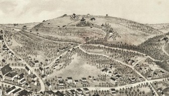
An 1878 map of New Canaan shows “Mount Lebanon” on what is now Brushy Ridge Road.”
Eventually, the Thomson’s opened up their property for New Canaanites to stroll through, maintaining a groomed walkway that began at an arch on lower Brushy Ridge Road and extended to another stone arch that resembled a Shinto Shrine near the top of the hill. The property soon was dubbed “Mount Lebanon” in honor of the trees that graced the walkway, and became a popular local attraction through the turn of the century.
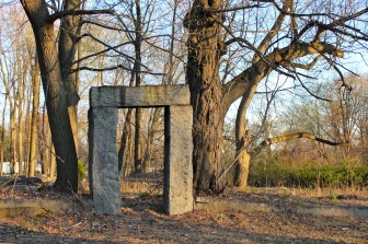
The other stone arch on Brushy Ridge.” credit=”Terry Dinan / NewCanaanite.com
Thomson passed away in 1918, and two years later The Rockery was destroyed in a fire. Although it had once been treated as though it was a public park, it was private real estate and was ultimately subdivided into several residences. The only indications alerting passersby to the former Mount Lebanon are the stone arches.
Jeff Urstadt has lived in one of the houses that were built on Thomson’s former estate for more than 25 years. The stone arch at the bottom of Brushy Ridge actually falls within Urstadt’s property lines, as does the former location of Thomson’s house.
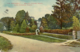
Another old postcard, erroneously titled “Brush Ridge Rd”.” credit=”
“Thomson’s house was right here,” Urstadt said, pointing at a span of flat lawn off to the side of his house where The Rockery once stood. “And I guess they distributed the rocks all over because I’ve got rocks all over my property, like everybody else.”
Also on Urstadt’s property are some vestiges of the past. The old concrete and lime horse trough – now filled in for safety reason – is still there, apparently fed by the same brook that did the job almost a century and a half ago. And steel spikes driven into some bedrock near the rear of the yard hint at some unknown past usage.
“There may have been a téléphérique or something that went down and carried stuff up here,” Urstadt said. “I painted them white so people wouldn’t trip.”
And on the south side of the property, behind the stone arch and rusted gate, hidden among the more-prominent maple and yew trees, rise some tall, somewhat forlorn evergreens–presumably Thomson’s cedars of Lebanon. Urstadt admits the trees have seen better days.
“They’re slowly coming down,” Urstadt told NewCanaanite.com. “They’re only flourishing on the top, not on the bottom.”
This is wonderful. I drive up Brushy Ridge nearly every day and always wondered what the history was behind the stone arch. Thank you and thanks to the Historical Society! (also, I looked up téléphérique – it’s an aerial tramway, similar to a gondola, used mainly in the Alpine regions of Europe ) Thanks!